Thursday, April 14, 2016

BIG SUR

DAY 10

WEDNESDAY 13 APRIL 2016

SAN SIMEON TO BIG SUR

0810- 2030 

110.32km (68.55 miles)
Av. Speed: 13 km/h (8.1mph)
Max. Speed 59.2 km/h (36.8 mph)
Time on Bike: 8h 27m 35s

Absolute marathon day.

Possibly one of the most gruelling days I've ever spent on a bike.

As prepared as I was, it was still mighty tough - physically and mentally.

12½ hours on the road - 8½ of those actually on the bike.

And hill after hill after hill after hill. Just when you thought you couldn't possibly take on another grade, another one appeared, just that bit longer and steeper than the last.

In spite of all this, I really did achieve what I set out to do.

Nearly 70 miles across this type of terrain with my monster rig was a goal which I considered ambitious from the outset.

To actually get there, even if it was in the dark with almost no gas left in the tank, was something I will buy myself a beer or two for in the days to come.

I could have easily pulled up stumps around 3.30 pm at Limekiln, which was an impressive location with a nice private little beach and hot showers but I was not in the least bit impressed with the $35 camping fee and the deep gully I would have had to push out of the next morning.

This was compounded by the misinformation given me by the duty ranger who was another that was "new around here" (there seems to be a few of these...) who assured me I could camp 14 miles to the north at Pfeiffer-Burns State Park which, when I got there, was indeed day use only.

It was already approaching 5.30 pm at Pfeiffer-Burns and with at least another 10 miles (by my count) to Big Sur, I was certainly going to be exploiting the remaining daylight today.

The other major issue with this part of the Californian coastal highway (that's the entire Big Sur part....) is that there is no shoulder for the greater part of it.

Now having ridden it however, it is the case that 99.9% of ALL drivers were extremely well behaved - courteous, careful and patient, which is a big ask when I was frequently crawling up long passes at no more than 5 km/h.

Clearly, this is a well-worn route for cyclists in both directions and with the omnipresence of signage along the way, it is something that drivers obviously do respect which is for the benefit of all.

The morning had begun well, with beautifully clear conditions and absolutely NO wind whatsoever, despite any number of warnings and forecasts to the contrary.

I wanted to make good with conditions in my favour, for sure.

First stop, aside from a few photo pauses, was the elephant seal rookery at Piedras Blancas.

I had intended to come by here after Hearst Castle the previous evening but would have overcooked what ended up being a very full day anyway.

The rookery was on the way out this morning, so it made much more sense.

Elephant seals gather here by the hundreds at different times of year but specifically for "molting" during the spring.

They are a sight and a half and pretty much look like they are "beached as" when you first look, but they are simply "chilling" en masse.

There are all sorts of games they play together, some of which border on violent but it's all pretty much part of the show.

It was totally a worthwhile stop for about 25 minutes to watch these beasts at rest and play in their natural environment.


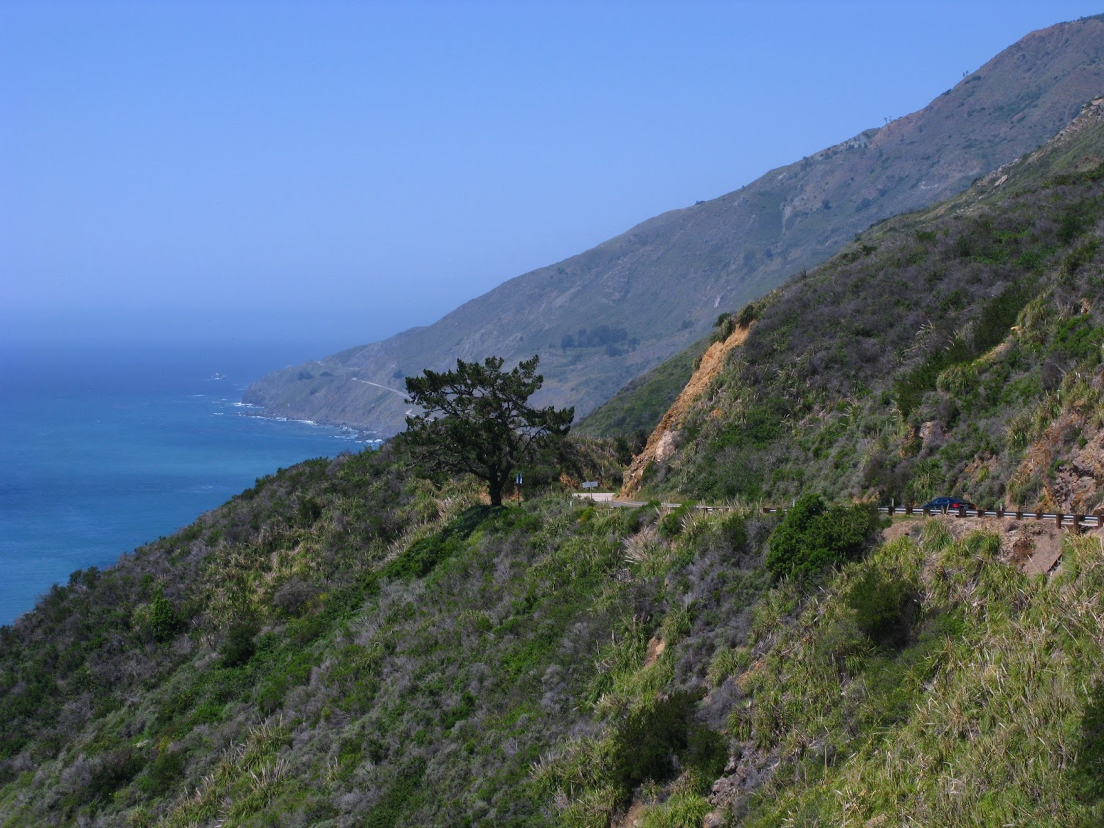
The Big Sur coastline is utterly dramatic and splendorous.

But of course, the drama is underscored by a highway route that negotiates the topography by way of a relentless series of grades and cutaways and hairpin curves, the majority of which cut close to the Pacific Ocean which at time is only metres away and often several hundred metres below.

You wouldn't want to lose your brakes on certain sections of this road.

I had driven Big Sur in 2004 in a hire vehicle and considered even then, what it would mean to ride it by bike.

"Just imagine...." I thought to myself at the time.

So now I know, and there's still a shade more to go yet....


SAN SIMEON & HEARST CASTLE

DAY 8

MONDAY 11 APRIL 2016

REST DAY IN MORRO BAY

DAY 9

TUESDAY 12 APRIL 2016

MORRO BAY TO SAN SIMEON

0810- 1915 (INCLUDES FULL AFTERNOON @ HEARST CASTLE)

64.56km (40.11 miles)
Av. Speed: 14.9 km/h (9.3 mph)
Max. Speed 56 km/h (34.8 mph)
Time on Bike: 4h 19m 06s

Morro Bay is probably the nicest place I've come across so far on this trip.

There's something about Tasmania in Morro Bay that I couldn't ignore - kind of like a posh version of Stanley on Tassie's north coast for anyone who's been there - you get the drift.

I had no trouble whatsoever spending my rest day there, doing the usual stuff.

The visitors' center here was particularly useful in lieu of the library being closed on a Monday (go figure that out...??) and allowed me use of the wi-fi all afternoon.

I made a point also of stocking up on supplies for the stage ahead as it was likely I would be remote camping for the next day or two along the Big Sur coastline.


MORRO BAY @ SUNSET

First things first and I made the decision to make the shorter trip through to San Simeon in order to visit Hearst Castle, the visionary but incomplete estate built by U.S media tycoon William Randolph Hearst from 1919 onwards.

With the earliest start of the tour so far, I made pretty good time through to San Simeon by midday and checked into the State Park campground for one night.


After excessive expense at some earlier camping grounds and other venues, the State Parks system in California caters specifically to cyclists by making available hiker/biker campsites for $5 per night.

This is a godsend for the many (such as myself) who are out there "doing it".

Unfortunately, whilst this does not apply to other venues that offer camping along the way (RV Parks in particular) the State Parks system is a beauty that should be taken full advantage of.by anyone who can.

After setting up, I packed a day kit and strapped it on to my trolley for a 5-mile scoot up the highway to Hearst Castle.

I had missed this experience on my previous visit in 2004, having reached San Simeon late on the day I had driven down the Big Sur coast and was determined to make amends this time.

The visitors center is well positioned just off Highway 1 and this is the meeting point for people from far and wide.

There are a choice of tours throughout each day and most have spaces available depending on your schedule.

I booked onto the final tour of the day for the "Upstairs Suites" 1-hour tour which would give access to the "Casa Grande" and its quarters, including Hearst's library, his personal bedroom, guest quarters and the "Gothic Suite" where Hearst would frequently work through the night taking phone calls all the while and poring over his daily publications in excruciating detail.

Prior to the tour commencing, there is an hourly viewing in the IMAX theatre of the 40-minute documentary "Building the Dream" which was well worthwhile.

IMAX cinematography is notoriously superb, using 70mm film format and plenty of 3D effects shown on over-sized screens, it perfectly suits the grand scale of the castle and its location

A shuttle bus leaves from the visitors center and winds 4.5 miles up the slope to the hill where the castle is built.

I thought initially that I would have to take the bike up all the way but thankfully not.

Once off the bus, the tour begins.

So, depending on your view of Hearst, his life and the film Citizen Kane, the Hearst Castle is stupendous in its magnitude, no matter where you stand.

Its location alone is astonishing, even if you were to build a yurt up here, the vistas of the Pacific coastline are unsurpassed.

The building itself is actually unfinished due to the fact that Hearst experienced depression-era financial difficulties in the late-1930's and simply did not complete the project.

And as a building of nearly a century old and being such an extensive and rambling structure, is subject to ongoing repairs and restoration, hence not all of it is available for public viewing at any given time.

Still on this day, I was able to get to most parts of the structure, unfortunately with the exception of the famous "Neptune Pool" which took a hit during the 2003 San Simeon earthquake (which racked up 6.6 on the Richter, just in case you were wondering) and is finally being attended to.

Other than this, we were told, the pool most likely would have been empty anyways due to the severe drought conditions currently imposing themselves throughout California.

Following the official part of the tour, we were free to wander and I was more than happy to do so with cameras in hand, naturally. 


Monday, April 11, 2016

BLESS PUBLIC LIBRARIES & VISITORS CENTRES

DAY 7

SUNDAY 10 APRIL 2016

PISMO BEACH TO MORRO BAY

1020 - 1815

59.71km (37.1 miles)
Av. Speed: 14.7 km/h (9.1 mph)
Max. Speed 48.4 km/h (30.1 mph)
Time on Bike: 4h 03m 41s

My general obsession with public libraries is quite understandable, I believe.

For a start I have worked in one, on and off, for 17 years.

Secondly without proper maps or GPS on this trip, they are my way forward.

Alternatively also, I have found some visitors centers in the past couple of days which have been more than helpful.

Pismo Beach VC was actually open on a Sunday, which suited me down to the ground.

This after running around like an idiot for the first hour looking for a library open on a Sunday.

I had ventured as far a Arroyo Grande for the (lost) cause although in doing so, rekindled memories of my previous visit to this area in 2004 as I clearly recalled having called into the Arroyo Grande library on a foggy March day back then....

If only I'd known about this little visitor's center....

From here, I made my way, ably assisted on this occasion by things they call maps.

Straight up Price Canyon Road out of Pismo Beach, I immediately entered the beautiful, rolling wine country of Edna, which for an hour or so, was an absolute delight.


EDNA VALLEY WINE COUNTRY 

Whether I'd intended it or not, I was also destined to re-acquaint myself with the town of San Luis Obispo, which I'd stayed at back in 2004.

When I hit SLO around lunchtime, cruising through the old town made me appreciate what a lovely little town SLO actually is.

It is a college town, which means heaps of young people.

And for my own selfish means, the California Polytechnic University also meant that their library was probably one of the only open on a Sunday.

With maps at hand, finding my way around for once, was quite straightforward.

I made way across to the highly impressive Cal Poly campus, which upon entry displays a football stadium which my Sydney team the Manly Sea Eagles would surely envy.

If poor old Brookvale Oval was half as glamorous and well appointed as this, the mighty Eagles would certainly have all their worries washed away.....

As hoped the Cal Poly library was well and truly open (until 2 am no less!!) which gave me access to Google Maps (bless...) and some time to catch up on this blog.

By 4.30, it was time to get moving to my destination, the beautiful Morro Bay where I planned a 2-night stay before taking on the Big Sur coastal highway between San Simeon and Monterey.


HILLS, WIND, RAIN, MUD, FARMS & SOME OTHERWISE FINE CALIFORNIAN RIDING

DAY 6

SATURDAY 9 APRIL 2016

LOMPOC TO PISMO BEACH

1040 - 1830

89.24km (55.45miles)
Av. Speed: 14.3 km/h (8.9 mph)
Max. Speed 70.4 km/h (43.7 mph)
Time on Bike: 6h 12m 45s

The provided bed in Lompoc was way too comfortable and I told Richard as much.

I could have easily slept all day but other things beckoned.

After a bite to eat at Richard's, I was on my way towards Pismo Beach.

Between us (that's me, Richard and Google Maps), we had devised a northward route that would get me where I intended to go.

Santa Lucia Canyon road took me straight out of Lompoc to the north, re-connecting with Highway 1 through the Vandenberg Air Force Base.

An alternate route that Richard recommended was San Antonio Rd West (a.k.a the Lompoc-Casmalia Rd) which passed through the small rural town of Casmalia, where there was apparently a very well-known steak house which looked to be in good time for lunch.

It was all pretty good running for the entire morning, and I was in particularly good spirits by the San Antonio turnoff, having just hit 70 km/h for the first time on my new bike.

The first 3 miles of San Antonio too, was divine riding - flat, peace and quiet in the midst of rolling hills flourishing with yellow mustard flowers and the contrasting mauve of lupine.

Oh yeah, and I forgot to mention the tailwind as well.

Rounding the right-hander at the golf course turnoff, I lost all favorable conditions in place of an extended grade, which dragged me steadily upward for the next 3 miles, the sun timing its first appearance of the day just as the hill started to pinch that little bit harder towards the top.

The downward side of the pass, as brief as it was, dropped me straight into Casmalia at about 1.15 pm, just in time for lunch as anticipated.

Problem was, the famous steak house known as "The Hitching Post", didn't open until 4.30.

Bugger.

So push on it was, to Santa Maria, where I was due to re-join the northward Highway 1, which would take me through to Pismo Beach.

As has been the regular routine so far, I got myself hopelessly lost in the bowels of Santa Maria, which I knew I was meant to avoid.

When I hit the 135/101 junction, my misdirection was confirmed. 

Back the same way I had come, at least temporarily, as I had noted the Santa Maria public library as I had passed it a mile or two up the way.

Once again, the local library came to the rescue as I was able to grab a few minutes of internet time to help right my wrong.

Immediately I could see how badly I had fucked it up, but thankfully the way out of it was not nearly as bad as it could have been.

In my own defence, I maintained how badly things are signposted (or not) and partially blamed that for missing the Highway 1 turnoff, several miles back.

Santa Maria library was on the junction of 135 and West Main, my out of this situation.

Trailing West Main would take me straight through to Guadalupe and a happy reunion with the 1.

Having already probably lost an hour, I wasted no more time and set out immediately.

Pedalling west along Main was straight into a headwind, which have thankfully mostly been absent so far.

And with the wind also came some sleeting rains which scraped into my face with some healthy wind assistance.

Light conditions also were poor, with the day advancing and the presence of dark storm clouds, it was not great riding.

Guadalupe is an area similar to those surrounding it which is heavily active in agriculture.

The effect of this was to turn what was normally a thick coating of dust on the roads adjacent to the plantations into slimy mud, which in some sections entirely covered the shoulder and road itself.

I nearly lost traction a couple of times and had to stop several others to let trucks pass me by on the narrow sections where there was no shoulder.

As relieved as I was to finally reach the Guadalupe township, the rain was now starting to pour down pretty steadily.

With only maybe 20 miles now through to Pismo and maybe 90 minutes of daylight left , I had to get moving. It would likely take all that time to get there.

From Guadalupe north, it was more rain, some short but sharp grades and intermittent afternoon sun which kept poking its head out of the layers of black clouds. 

There were a couple of aggressive drivers too, who should have focused a little more on slowing the fuck down in poor conditions rather than trying to run me off the road.

I pulled into Pismo Beach around 6.30, in fading light and after 90 kilometres on the road in sometimes trying conditions, was happy to pull into the first camp I came across.

In hindsight, probably the worst option available, it was a ramshackle affair, strategically positioned between Highway 1 and the Amtrak rail line.

With time enough to shop around, I would have readily gone a mile or so up the road and stayed at North Beach, but it was not to be.

As I found the overgrown patch of grass that doubled as the hiker/biker camp spot, I proceeded to pitch my tent in the company of hundreds of mosquitos.

Still, beggars can't be choosers they say and for a princely sum of US$13, I had found a camp and an inclusive hot shower, which had to count for something.

I had decided one thing for sure though;  I would be moving on tomorrow.


THE FIRST RAINS.....

DAY 4

THURSDAY 7 APRIL 2016

DAY OFF IN SANTA BARBARA

Time for a break to gather myself and Santa Barbara seemed as good a place as any to do so.

Get some laundry done, catch up on my blog, edit some video, rest the body etc...

The Wayfarer was certainly pick of the bunch as far as a place to stay, however it was not certain they could fit me in for a second night.

"Wait until midday" was the suggestion from behind the counter. Someone may cancel.

It so happened that I needed to visit a bicycle shop in State Street to pick up some inner tubes I had ordered from Los Angeles.

Nowhere in L.A stocked the particular tubes I needed and the first place I contacted in Santa Barbara did.

So an hour-long morning stroll along State Street to collect the tubes (which had arrived) and top up some cash from an ATM successfully got me through until 11.30 at which time I returned to the Wayfarer.

No good news unfortunately in terms of cancellations.

They did however have a single room left that was going to cost me a bomb for the extra night - certainly not ideal, but I took it.

The room was free by 1 pm so I moved my stuff and spent the remainder of the afternoon editing video and blogging.

As dinner time approached I was supremely hungry from laying about all day and was keen on another round of Mexican from up on State Street.

Throughout the day, I had befriended a young lady in the hostel from Malaysia who was not nearly so enthused about it, so we went for a wander and landed instead upon some Himalayan fare which was as good if not better, especially since I got to try yak for the first time ever.....


STATE ST & THE WAYFARER, SANTA BARBARA

DAY 5

FRIDAY 8 APRIL 2016

SANTA BARBARA TO LOMPOC

1040 - 1800

82.37km (51.18miles)
Av. Speed: 15.4 km/h (9.6 mph)
Max. Speed 69.4 km/h (43.1 mph)
Time on Bike: 5h 20m 31s

It had rained on Thursday throughout the day and when I woke on Friday the road surfaces were well lacquered.

The rain that continued to fall was not heavy and my plans were not about to change.

Next destination I had earmarked was Lompoc (that's LOM-POKE) approximately 50 miles north.

Once again researching my northward route thoroughly before departure, there was a couple of options left to me, one of which inevitably involved some time on 101.

The alternate route on 154 over San Marcos Pass was, as the name suggests, a mountain pass and whilst most likely more spectacular, was also less direct (and on good advice from a local, a little more winding, narrow and hazardous.)

After careful consideration, I conceded that this time, the equally hazardous 101 was unavoidable but I had divined a route that would minimise contact with it.

Probably just as well also, as visibility was compromised in the rainy conditions.

The rains persisted, at times quite heavy, as I made way through the suburban sprawl of Santa Barbara and Goleta.

I continued until the 110 exit at which I braced myself for my first serious stint on the freeway.

The chosen route would keep me there until the 116 exit and then off again until 120 where I would rejoin until the 132 exit at Gaviota.

Between 110 and 116, conditions were bad.

Quite heavy rain with trucks, cars and anything else whistling by my left ear at close range.

The shoulder too, whilst mostly usable was littered with all kinds of shit - loose gravel in particular which I'm sure was just there to make my life more difficult.

Fortunately, I made pretty good time in spite of everything and the 116 exit came up before I knew it.

Never had I been happier to veer off and continue elsewhere.

A brief corridor of bike path ensued, before I decided to re-enter the fray at 117, a little earlier than planned, but when I glanced across to my right and saw the grades that the alternate Calle Real was rolling across, I was not overly sorry to be where I was.

In fact, from 117 through to the 132 off ramp, the running was pretty good.

The rain gradually eased, the shoulder cleared up and somehow also, the traffic seemed less.

I also had a good clip of speed up for a good part of it, which always should put a smile on the cyclist's face....

A brief pause at the Gaviota rest stop pushed me on for another mile until the 132 exit.


ABOUT TO ENTER THE GAVIOTA TUNNEL

From 132, I had now re-connected with the PCH and a relatively short 20-mile stretch into Lompoc, which is where I planned to make camp for the night.

Immediately, the PCH was pointed straight for the heavens as by far the biggest pass I have encountered lay before me.

Steep, long and well-trafficked, I prepared myself for a long haul up this one.

I decided from scratch that the best approach was to do it in stages; otherwise it was just going to wear me down.

Do a bit. Stop. Drink. Do a bit. Stop. Drink. I repeated this routine up to 10 times in order to reach the top.

Curiously about half way up, someone had pulled over on my side and as I approached, could see he was fiddling with a camera tripod.

As I came a little closer even, I could see he was taking photos of me.

“You wanna swap??” I offered, as I came within earshot.

I could see the fellow chuckling and shaking his head in the negative.

We exchanged a few pleasantries as I caught my breath and I also happened to mention I was headed for Lompoc, just as he happened to mention that he owned a recumbent.

I also made a point of asking if he could forward any photos that he had taken of me, as I handed him a card and explained about the blog, blah, blah, blah.


GRINDING UP GAVIOTA PASS (THANKS TO RICHARD FOR THE PIC...)

Continuing, I thought little more about it until another 10 miles or so along, he was pulled up again taking more photos of me as I topped another pass, albeit somewhat lesser than the previous Gaviota Pass.

This time he made the opening gesture.

“Would you care for a roof over your head tonight?”

“Sure!” was my instant response. “Where am I going?”

At this, I was handed a mud map of directions to his house and agreed to see him when I got there, which from where we were was only about 30 minutes.

Beauty.

I love it when stuff like this happens when you’re travelling.

And so it was that I stayed in Lompoc, California with Mr Richard Wolfe for the night.


RICHARD WOLFE HOSTED ME OVERNIGHT IN LOMPOC


Sunday, April 10, 2016

AVOIDANCE 101 a.k.a 101 AVOIDANCE


DAY 3

WEDNESDAY 6 APRIL 2016

OXNARD – SANTA BARBARA

1040 - 1800

76.53 km (47.55 miles)

Av. Speed: 16.4 km/h (10.2 mph)

Max Speed: 42.9 km/h (26.6 mph)

Time on Bike: 4h 39m 34s


I got myself out of the Flamingo in good time with the stated intention of getting to Santa Barbara.

Oxnard Public Library was the first stop off for a spot of internet time, post another blog entry, that sort of thing.

More importantly I had decided to lose some weight off the rig and it was time to post some items home.

Having used the US postal service previously in 2004, I had no doubts about reliability – cost on the other hand….

Anyway, US$95 later, my little package was on its way back to Sydney from Oxnard and already the rig was thanking me for it.

My mission for the day from this point was to get to Santa Barbara with as minimal contact with Highway 101 as possible.

101 is not an Interstate, and therefore not an illegal for bicycles.

In terms of safety and enjoyment however, this is another matter.

The good news was that apparently it was possible - by way of an intricate network of bicycle paths that have been provided to enable cyclists to negotiate the northward PCH route.

It wasn’t necessarily a piece of pie, but it was possible as I understood it.

I must admit that I have never attempted to ride from one city to another entirely using a bicycle path network so that in itself promised some kind of adventure.

The first section of the ride I had completed the previous evening as I attempted to find a camp in the fading light but found myself stopping a second time on the way back through to take a piss on the “CLOSED” sign that had undone me so.

Revenge can be sweet sometimes.

I perhaps had not quite appreciated that the good sized centre of Ventura was as close as it was. I was there in no time but got lost for the first time by missing the poorly marked turnoff which I needed to take to pick up the cycle path.

Enquiring at the nearby gas station at the 101 junction got me nowhere (as it has done several times so far…no one seems to know ANYTHING around here!!)

Still, I back-tracked a half-mile or so and managed to connect with the sign I had missed and was back on track at least temporarily.

The southern head of the cycle way was in the midst of a new quayside housing development (think Pleasantville with shiny boats in the garage) which I found a little bizarre but as the signs were telling me it was the way to go, so who was I to argue?

Within 5 minutes or so, I was off the road and onto the beachfront path which runs immediately in front of the main downtown area of Ventura.

The path is a beauty and it completely relieves the pressure of having to deal with traffic – for the best part of 5 miles, no less.

WATCH ME RIDE THE VENTURA CYCLE PATH!!

I made an obligatory lunch stop at the Beach Taco House for some local delicacies; a couple of fresh fish tacos and a spicy rice milk iced tea went down an absolute treat.


BEACH HOUSE TACOS, VENTURA BEACHFRONT

After mopping up the mess I had made with the tacos (coleslaw and chipotle sauce absolutely everywhere), I continued, hitting the serious section of the bicycle path within 30 minutes.


This is about a 10 mile designated construct that runs directly adjacent to 101 on the right and the Pacific Ocean on the left – you are no more than 20 metres from either for the full extent of the path.

Fabulous riding indeed!

And as you come off at the northern end, the path does actually re-join the road as Highway 1 for about another 10 miles, however traffic is low and the ocean vista to the immediate left is only interrupted by the occasional Amtrak train running along right next to the road and the incessant hum of 101 just over the embankment.

Everything I would have said was hunky dory until the exit at Rincon Park and this is where things started to get just a little fucked up.

To my dismay, the next direction I followed led me directly onto 101, albeit for a very short period until the next freeway exit.

It was here I came across the first bogus signing which ended me up in a construction zone with no way through.

Consulting the “construction guys” at least gave me a direction to follow, although their assertion that taking “Via Real” all the way into Santa Barbara proved to be a lot of bull.

From this point, I probably got lost a minimum of 10 times and although I remained certain that I was actually heading in the right direction at all times, the way through proved to be entirely convoluted and counter-intuitive.

To the credit of all locals that I consulted during the next 2-3 hours, almost all of them gave the right directions which at least got me to the next dead-end or inadequate signage.

Miraculously I made it to an RV Park I had earmarked as a possible camping spot which had come up somewhere on the map – there was no way in the world I could have located it by myself – but was told by the manager on arrival that camping was actually not possible, not there, or anywhere in Santa Barbara apparently.

Fabulous.

Said manager did however give me forward directions, which was softened by the fact that I was apparently less than a mile from downtown Santa Barbara.

With the hour now closer to 7 pm than 6 pm, I initially found the tourist information centre closed, of course, but was able to interpret the provided map sufficiently enough to find the main street (State St) and that most golden of institutions, the public library.

Although I had visited Santa Barbara more than once 12 years previously, I had scant memories of the town and its set up, although did recognise the Amtrak station when I saw it and did recall a nearby hostel that I seemed to remember staying at.

The library, I felt would provide all I needed to know when I found it.

And it did.

I located 2 hostels in the downtown area and re-mounted my steed to go and track them down. (The HI hostel I stayed at in 2004 is apparently no longer, BTW….)

If they had an available room, the first hostel on the list is the one I decided I was going to stay at before I even got there.

“The Wayfarer” looked by far the superior of what was on offer and it was also in a much closer location.

And so it came to be for the next 2 nights.